And very interesting it is too, not least because they've used the old pre-1970s "traditional" county list including things like Huntingdonshire and Westmorland and various other places that have long since disappeared from the map. So it's more in line with this Wikipedia list than the one I was using. Hopefully the magazine's lawyers will forgive me if I reproduce the county map:
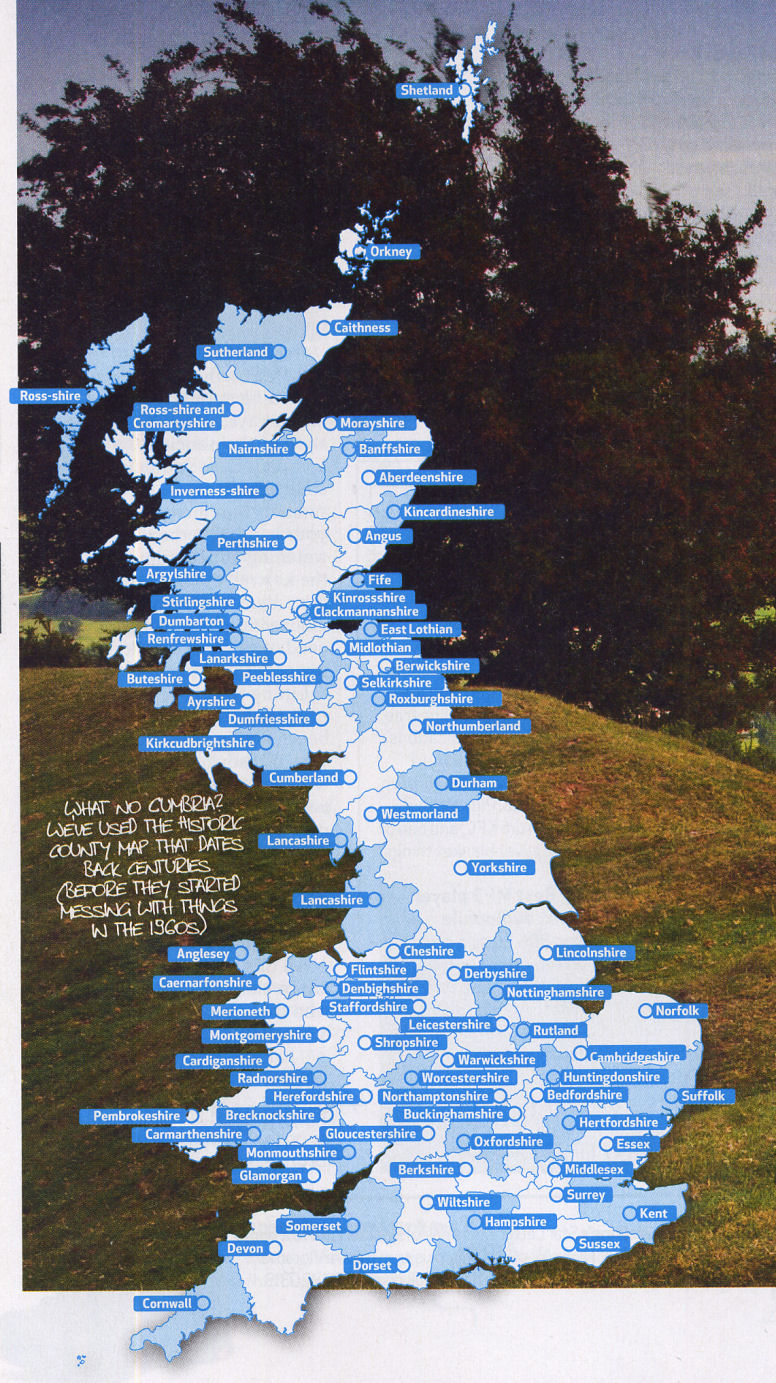
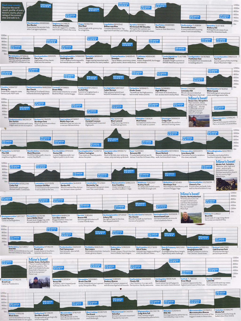
....and also the list of high points, complete with Ordnance Survey grid references (which can be plugged directly into Multimap, among other things).

In both cases you can click on the image for a larger version. The summit list has a lot of useful text in it so if you want a higher-quality PNG version you can obtain one here. The pedantically eagle-eyed among you will notice that the graphical representations of Berwickshire (too low - compare it with the picture for East Lothian which represents the same hill), Norfolk (too high) and Worcestershire (too low) are somewhat on the piss (the stated heights are correct).
I notice also that we've totally missed the boat on writing a book on the subject: Journalist Jonny Muir's book Heights of Madness , which describes the author's adventures touring round the country on a mountain bike scaling all the county tops, will be out in May. I wish it (through clenched teeth) every success, naturally.
2 comments:
It's an interesting decision to use the old counties list - I kinda wonder why they did that? (unless it was a glaring error on behalf of the magazine - or maybe a 2 fingers to the establishment lol).
It sounded from the article as if it was a conscious choice on the magazine's part - possibly they were making a political point of some sort, but I think it's more likely that the old list gives you a group of counties more sensibly distributed in terms of size, i.e. you don't have the tiny unitary authorities like Milton Keynes, nor the ludicrously huge counties like Powys.
Or maybe using the old list just gives you a more interesting group of hills, with more of the recognisable "big" ones on it.
Maybe I'm thinking about it too much....
Post a Comment